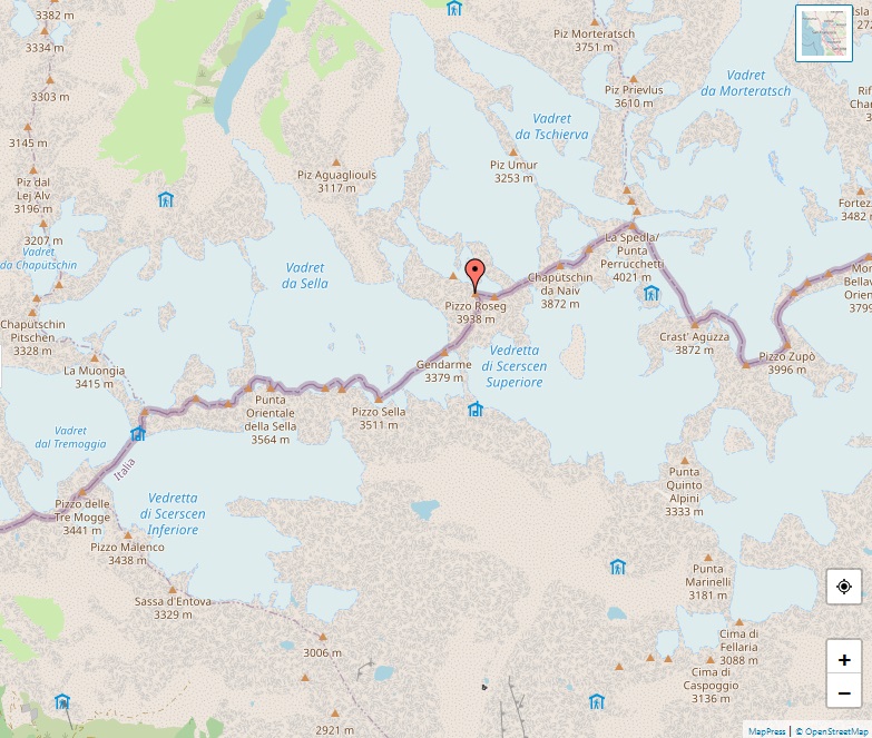
Grosses Wannenhorn

Alps, map of Grosses Wannenhorn

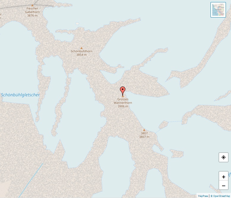
The Grosses Wannenhorn stands proudly at an elevation of 3,906 meters, nestled in the heart of the Bernese Alps in the Valais canton of Switzerland. This striking mountain, part of the Walliser Fiescherhörner group, commands attention with its imposing stature and rugged terrain. It plays a significant role in the alpine landscape, acting as a … Read more

Pic Sans Nom

Alps, map of Pic Sans Nom

The Pic Sans Nom, soaring at an elevation of 3,913 meters, stands as a majestic and enigmatic mountain in the Massif des Écrins of the French Alps. Known as the “Nameless Peak,” it embodies the mystery and allure that attracts mountaineers and nature enthusiasts alike. Situated in the Hautes-Alpes region of France, this mountain is … Read more

Aiguille de Tré la Tête

Alps, map of Aiguille de Tré la Tête

The Aiguille de Tré la Tête, towering at 3,930 meters, is a prominent mountain in the southern part of the Mont Blanc massif. Straddling the border between Italy and France, this peak is notably recognized for its highest point, the central southeast pinnacle, situated in Italy. The mountain is distinguished by four significant summits: the … Read more

Trugberg

Alps, map of Trugberg

The Trugberg, a notable mountain in the Swiss Bernese Alps, stands at an elevation of 3,933 meters. It’s situated south of the Mönch in the canton of Valais and prominently overlooks the Konkordiaplatz. This unique position allows the Trugberg to witness the convergence of the Jungfraufirn and the Ewigschneefeld, which together form the source of … Read more

Bietschhorn

Alps, map of Bietschhorn

The Bietschhorn, towering at 3,934 meters, is an eminent peak in the Swiss canton of Valais, nestled within the southern part of the Bernese Alps. It is prominently positioned on the south side of the Lötschental valley, marking the north end of both the Bietschtal and Baltschiedertal valleys. This striking mountain forms a part of … Read more

Piz Roseg

Alps, map of Piz Roseg

Piz Roseg, standing tall at 3,937 meters, is a prominent peak in the Bernina Range, majestically overseeing the Val Roseg in the Swiss canton of Graubünden. The mountain features two significant summits on its main ridge: the southeast and higher summit at 3,937 meters, and the northwest summit known as Schneekuppe at 3,920 meters. Additionally, … Read more

Mont Pelvoux

Alps, map of Mont Pelvoux

Mont Pelvoux, a majestic mountain in the Massif des Écrins of the French Alps, stands impressively at an elevation of 3,946 meters. For a considerable time, it was mistakenly thought to be the highest peak in the region, overshadowing the taller Barre des Écrins which remains hidden from view in the Durance valley. The mountain’s … Read more

Ailefroide

Alps, map of Ailefroide

The Ailefroide, soaring to an elevation of 3,954 meters, is a prominent mountain in the Massif des Écrins of the French Alps and ranks as the third highest peak in the Dauphiné Alps, following the Barre des Écrins and La Meije. It is situated at the south-western extremity of the Mont Pelvoux–Pic Sans Nom–Ailefroide ridge, … Read more

Grand Cornier

Alps, map of Grand Cornier

The Grand Cornier, standing at an impressive 3,962 meters, is a notable mountain in the Pennine Alps in Switzerland, conveniently located about 2 kilometers north of the Dent Blanche. This remarkable peak holds a special place in the annals of mountaineering history, being first ascended on June 16, 1865, by a team comprising the renowned … Read more

Grivola

Alps, map of Grivola

The Grivola, peaking at 3,969 meters, is a significant mountain located in the Graian Alps in Italy, nestled between the Valsavarenche and the Cogne Valley. This majestic peak has been known by various names in the past, including Pic de Cogne, Grivolet, Bec de Grivola, and Aiguille de Grivola. The name “Grivola” first emerged in … Read more