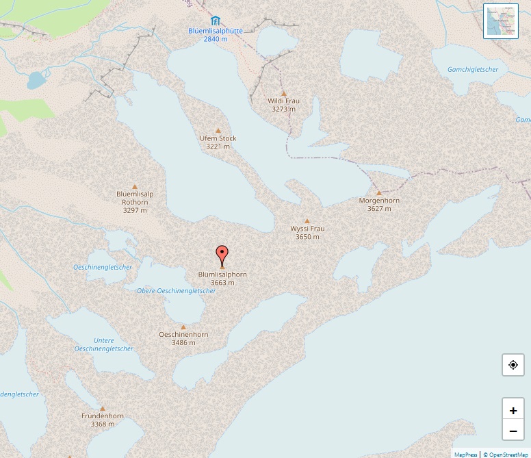
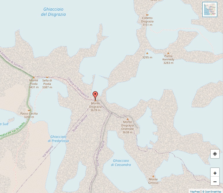
Portjengrat

Alps - Map of Portjengrat

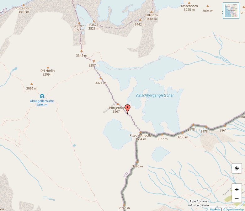
Portjengrat, also known as Pizzo d’Andolla, is a significant peak in the Pennine Alps, straddling the border between Switzerland and Italy. Rising to 3,654 meters, it is positioned south of the Weissmies and near the Zwischbergen Pass. This peak marks the tripoint where the Saas, Divedro, and Antrona valleys converge, standing as the highest point … Read more

Blüemlisalp

Alps - Map of Blüemlisalp

Blüemlisalp, a notable massif in the Bernese Alps, stands within the Swiss municipalities of Kandersteg and Reichenbach im Kandertal. This impressive range comprises several key peaks: Blüemlisalphorn at 3,661 meters, Wyssi Frau at 3,648 meters, and Morgenhorn at 3,623 meters. Located entirely within the canton of Berne, Blüemlisalp forms a high ridge, notable for its … Read more

Les Agneaux

Alps - Map of Les Agneaux

Les Agneaux, nestled in the Massif des Écrins in Hautes-Alpes, France, is a significant peak standing at 3,664 meters. This mountain, situated within the commune of Pelvoux, is a prominent feature of the Écrins massif’s eastern landscape. The mountain is distinguished by its three summits: the Agneau Blanc at 3,631 meters, the northwest summit at … Read more

Großvenediger

Alps - Map of Großvenediger

Großvenediger, standing at 3,666 meters, is a notable peak in the Venediger Group of the Hohe Tauern mountain range, straddling the border between Tyrol (East Tyrol) and Salzburg in Austria. This glacier-capped summit is nestled in the Hohe Tauern National Park and is considered Austria’s fourth highest mountain. The mountain’s name, Großvenediger (Great Venetian), first … Read more

Les Bans

Alps - Map of Les Bans

Perched in the heart of the Massif des Écrins in the Dauphiné Alps, Les Bans, standing at 3,669 meters, is a prominent feature in the French Alps. It was first ascended on July 14, 1878, by an expedition led by W. A. B. Coolidge, accompanied by guides Christian Almer and U. Almer. The mountain is … Read more

Dômes de Miage

Alps - Map of Dômes de Miage

Nestled in the Mont Blanc massif’s southern reaches, the Dômes de Miage stand majestically, reaching up to 3,673 meters. This magnificent snow-clad arête, extending over three kilometers, showcases a sequence of six peaks. From southwest to northeast, these include the notable L’Aiguille de la Bérangère, followed by a series of unnamed summits identifiable by their … Read more

Dent de Perroc

Alps - Map of Dent de Perroc

Dent de Perroc stands as a majestic peak in the Swiss Pennine Alps, dominating the landscape with its impressive elevation of 3,676 meters. Located in the canton of Valais, this mountain presents a grand spectacle, especially when viewed from the village of Arolla. As a significant feature in the Alps, Dent de Perroc forms a … Read more

Uia di Ciamarella

Alps - Map of Uia di Ciamarella

Uia di Ciamarella, also simply known as Ciamarella, rises to an elevation of 3,676 meters, marking the border between France and Italy. Nestled in the Graian Alps, this mountain is a striking feature in the landscape, drawing the attention of mountaineers and nature enthusiasts alike. Classified under the SOIUSA system, Uia di Ciamarella falls within … Read more

Punta San Matteo

Alps - Map of Punta San Matteo

Punta San Matteo, a notable peak of the Ortler-Vioz range in the Ortler Alps, straddles the border between Lombardy and Trentino-Alto Adige/Südtirol in northern Italy. Standing at 3,678 meters, this mountain is not just a magnet for climbers but also a historical site, having been the battleground of the highest altitude warfare during World War … Read more

Monte Disgrazia

Alps - Map of Monte Disgrazia

Monte Disgrazia, standing at 3,678 meters, is a prominent peak in the Bregaglia Range of the Italian Alps. Known in Lombard as Mont Des’giascia, which translates to ‘Mount Defrost,’ it is the highest summit in the Val Masino group, located south of the famed Bernina Range. This granite mountain is characterized by its challenging topography, … Read more