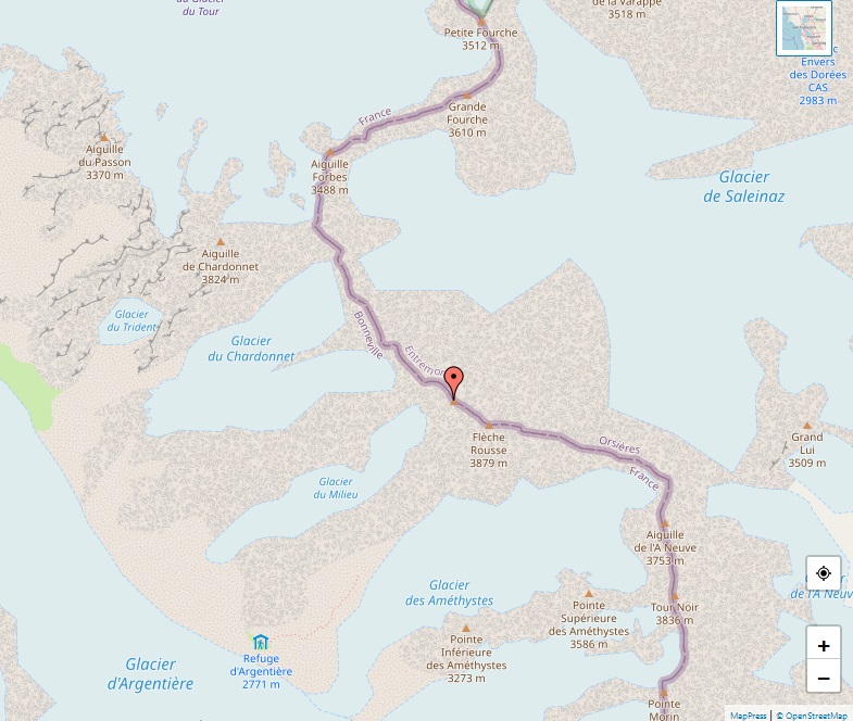
Tour Noir

Alps - Map of Tour Noir

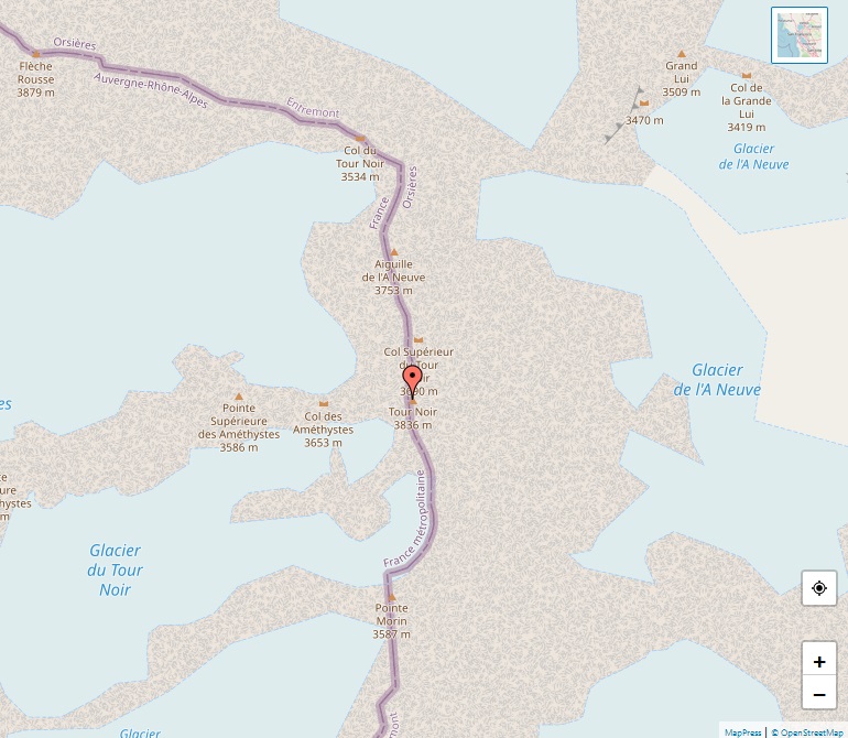
The Tour Noir, a notable peak in the Mont Blanc Massif, that stands at an elevation of 3,836 meters. This mountain marks the border between Switzerland and France, nestled between the Aiguille d’Argentière and Mont Dolent. Its prominence of 302 meters adds to its impressive stature within the alpine landscape. The Tour Noir is a … Read more

Bouquetins

Alps - Map of Bouquetins

The Dents de Bouquetins, commonly known as the Bouquetins, is a striking multi-summited mountain located at the border between Switzerland and Italy. Part of the majestic Pennine Alps, this mountain ridge is composed of several peaks that rise above 3,600 meters, with the highest point reaching an impressive altitude of 3,838 meters. Its name, Bouquetins, … Read more

Monte Viso

Alps - Map of Monte Viso

Monte Viso, often referred to as Monviso in Italian, stands as the highest mountain in the Cottian Alps at an elevation of 3,841 meters (12,602 feet). This majestic peak, located in the Piedmont region of Italy, near the French border, is renowned for its distinct pyramid-like shape. The mountain’s unique structure and elevation, rising approximately … Read more

Aiguille du Midi

Alps - Map of Aiguille du Midi

The Aiguille du Midi, a striking peak in the Mont Blanc massif of the French Alps, stands at an impressive height of 3,842 meters (12,605 feet). Renowned for its breathtaking views and unique geographical features, it is a sought-after destination for tourists and adventure enthusiasts alike. One of the Aiguille du Midi’s most notable attractions … Read more

Königspitze

Alps - Map of Königspitze

Königspitze, also known as Gran Zebrù, stands majestically in the Ortler Alps, straddling the border between South Tyrol and the Province of Sondrio in Lombardy, Italy. With an elevation of 3,851 meters (12,635 feet), it holds the distinction of being the second-highest peak in the Ortler Alps, surpassed only by the Ortler itself. The mountain’s … Read more

Grande Casse

Alps - Map of Grande Casse

The Grande Casse, standing at an impressive elevation of 3,855 meters (12,648 feet), is the highest peak in the Vanoise Massif of the Graian Alps, located in the Savoie department of France. It’s nestled in the Vanoise National Park, close to Pralognan-la-Vanoise and approximately 25 km southeast of Moûtiers. The mountain is renowned for its … Read more

Aiguille de Triolet

Alps - Map of Aiguille de Triolet

The Aiguille de Triolet stands as a magnificent peak within the Mont Blanc massif, marking the border between France and Italy. At a towering height of 3,870 meters (12,697 feet), it forms a significant part of a ridge that also includes notable summits like Mont Dolent and the Grandes Jorasses. Dominating the eastern side of … Read more

La Ruinette

Alps - Map of La Ruinette

La Ruinette, standing at an imposing height of 3,875 meters (12,713 feet), is a remarkable peak within the Swiss Pennine Alps, commanding a majestic presence over the Lake of Mauvoisin in the canton of Valais. Notably, it is the highest point in the range that stretches between the Grand Combin and the Dent Blanche, making … Read more

Aiguille d’Argentière

Alps - Map of Aiguille d'Argentière

The Aiguille d’Argentière, with its towering height of 3,901 meters (12,799 feet), is a notable peak in the Mont Blanc massif, straddling the border between France and Switzerland. This majestic mountain is an integral part of the alpine landscape, contributing significantly to the grandeur of the Graian Alps. This impressive peak was first successfully ascended … Read more

Ortler

Alps - Map of Ortler

Rising majestically to 3,905 meters (12,812 feet), Ortler stands as the highest mountain in the Eastern Alps outside the Bernina Range. This colossal peak, nestled in the heart of the Ortler Alps, holds the distinction of being the tallest in the Southern Limestone Alps and South Tyrol, Italy. Its prominence extends beyond geography; until 1919, … Read more